Categories
City of Muscatine Press Releases

Preparedness key lesson of Severe Weather Awareness Week

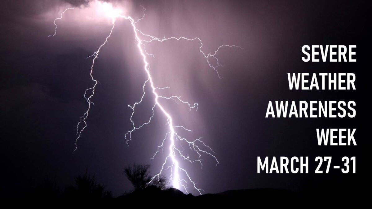
MUSCATINE, Iowa – The Iowa Department of Homeland Security and Emergency Management (HSEMD), National Weather Service (NWS), and Iowa Emergency Management Association (IEMA) have joined together to promote Severe Weather Awareness Week, March 27-31. 

“Iowa is no stranger to severe weather,” said HSEMD Director John Benson. “We frequently see tornadoes, flooding, straight-line winds and even derechos. So take the time now to prepare yourself and your family so you know what to do if severe weather is headed your way.”

Benson urges Iowans to take three simple steps to be better prepared:

  • Be aware of weather hazards by signing up for emergency notifications through Alert Iowa (alert.iowa.gov) or use a NOAA Weather Radio or other type of alerting tool.
  • Make an emergency plan with your family. Think about where you will go and what actions you will need to take to stay safe if you are impacted by severe weather.
  • Build an emergency kit with items you and your family will need if you must evacuate your home.

For each day during Severe Weather Awareness Week a different subject will be highlighted:

  • Monday – Severe thunderstorms
  • Tuesday – Weather alerts
  • Wednesday – Tornadoes
  • Thursday – Family preparedness
  • Friday – Flash floods

The annual statewide tornado drill will take place on Wed., March 29, beginning at 10 a.m. during the weekly NOAA Weather Radio test. In the event of severe weather, the drill will be postponed to March 30 at 10 a.m. Additional information about the tornado drill can be found on local NWS websites.

SEVERE THUNDERSTORMS

The National Weather Service officially defines severe thunderstorms as storms that are capable of producing hail that is an inch or larger or wind gusts over 58 mph. Hail this size can damage property such as plants, roofs, and vehicles. Wind this strong is able to break off large branches, knock over trees, or cause structural damage to trees.

Some thunderstorms can produce hail larger than softballs or winds over 100 mph, so please pay attention to the weather as you know when severe storms are possible. Thunderstorms can also produce tornadoes and dangerous lightning, and heavy rain can cause flash flooding.

To learn more, visit the Severe Thunderstorm Safety page on the National Weather Service website.

Learn About Thunderstorms

Thunderstorm Safety (PDF)

RECEIVING WARNING INFORMATION

Today’s technology offers many ways to be alerted to severe weather. The most important point is to be intentional and proactive by having multiple ways to receive warnings, know which hazards alert on the various systems, choose the alert methods that work best for you in different situations (at home, at the ball park, etc.), and react quickly when the hazard occurs.

Some types of alerting systems include:

WEATHER WARNINGS

Do you know the difference between a National Weather Service Severe Thunderstorm Watch and a Severe Thunderstorm Warning? Check your knowledge below.

Severe Thunderstorm Watch: Be Prepared! Severe thunderstorms are possible in and near the watch area. Stay informed and be ready to act if a severe thunderstorm warning is issued. The watch area is typically large, covering numerous counties or even states.

Severe Thunderstorm Warning: Take Action! Severe weather has been reported by spotters or indicated by radar. Warnings indicate imminent danger to life and property. Take shelter in a substantial building. Get out of mobile homes that can blow over in high winds. Warnings typically encompass a much smaller area (around the size of a city or small county) that may be impacted by a large hail or damaging wind identified by an NWS forecaster on radar or by a trained spotter/law enforcement who is watching the storm.

Watches and Warnings (PDF)

TORNADO SAFETY

A tornado is a violently rotating column of air extending from the base of a thunderstorm down to the ground. Tornadoes are capable of completely destroying well-made structures, uprooting trees, and hurling objects through the air like deadly missiles. Tornadoes can occur at any time of day or night and at any time of the year. Although tornadoes are most common in the Central Plains and the southeastern United States, they have been reported in all 50 states.

To learn more, visit the Tornado Safety page on the National Weather Service website.

FAMILY PREPAREDNESS

There are three simple steps that you can take to be more prepared at any time of the year for any emergency including weather related hazards.

  • Build A Kit – Create an emergency supply kit that would have everything that you would need to sustain you and your family for three to five days.
  • Make A Plan – Knowing what to do in the event of an emergency is key. Make sure that everyone in your family knows what to do in the event of an emergency and practice that plan.
  • Be Aware – Learn about the hazards that can affect your community, and learn how to get information about current weather and road conditions.

More information can be found at READY IOWA.

FLOOD SAFETY

Flooding is a coast-to-coast threat in the United States and Muscatine has the annual threat of spring flooding of the Mississippi River. The National Weather Service offers a Flood Safety Tips and Resources page with valuable information on what to do before a flood, during a flood, and after a flood.

While there is more time to prepare for river flooding, there is little time to prepare for a flash flood, a rapid rise of water in low-lying areas that can be caused by heavy rain, ice or debris jams, and levee or dam failure. The most common cause in Muscatine is copious amounts of rainfall from thunderstorms. Remember to turn around and don’t drown.

Types of Advisories, Watches and Warnings

The information provided on the Ready Iowa Be Aware page is courtesy of the National Weather Service (NWS). These are hazards that regularly affect the state of Iowa. For additional information, visit your local NWS website.

Floods

  • A flood watch is issued when current and developing conditions are such that there is a threat of flooding, but the occurrence is neither certain nor imminent.
  • A flood warning is issued when there is flooding along larger streams causing a serious threat to life or property. A flood warning will usually contain river stage (level) forecasts.
  • A flash flood watch indicates that flash flooding is possible in and close to the watch area. Those in the affected area are urged to be ready to take quick action if a flash flood warning is issued or flooding is observed.
  • A flash flood warning signifies a dangerous situation where rapid flooding of small rivers, streams, creeks, or urban areas is imminent or already occurring.

Heat

  • A heat advisory is issued within 12 hours of the onset of the following conditions: heat index of at least 105°F but less than 115°F for less than three hours per day, or nighttime lows above 80°F for two consecutive days.

Tornadoes/Wind

  • A tornado watch means that conditions are favorable for the development of tornadoes in and close to the watch area.
  • A tornado warning means that a tornado is indicated by radar or has been sighted by storm spotters. The warning will include where the tornado is and what towns will be in its path.
  • A wind advisory is issued with sustained winds from 25 to 39 mph and/or gusts to 57 mph.

Severe Thunderstorms

  • A severe thunderstorm watch means that conditions are favorable for the development of severe thunderstorms in and close to the watch area.
  • A severe thunderstorm warning is issued when a thunderstorm produces hail 3/4 of an inch or larger in diameter and/or winds which equal or exceed 58 mph. Severe thunderstorms can result in the loss of life and/or property. Information in this warning includes: where the storm is, what towns will be affected, and the primary threat associated with the storm.

The NWS developed two new categories of damage threat for Severe Thunderstorm Warnings. These tags and additional messaging are designed to promote immediate action, based on the threats.

  • The criteria for a destructive damage threat are at least 2.75-inch diameter (baseball-sized) hail and/or 80 mph thunderstorm winds. Warnings with this tag will automatically activate a WEA on smartphones within the warned area.
  • The criteria for a considerable damage threat are at least 1.75-inch diameter (golf ball-sized) hail and/or 70 mph thunderstorm winds. This will not activate a WEA.

Winter Weather

  • A winter storm watch indicates that severe winter weather may affect your area.
  • A winter storm warning indicates that severe winter weather conditions are definitely on the way or are already here.
  • A blizzard warning means that large amounts of falling or blowing snow and sustained winds of at least 35 miles per hour are expected for several hours.
  • A blowing snow advisory is issued when wind-driven snow reduces surface visibility, possibly hampering travel.
  • A wind chill advisory is issued when the wind chill could be life threatening if action is not taken.
  • A wind chill warning is issued when the wind chill is life threatening.
  • A freezing rain/drizzle advisory is issued when freezing rain or freezing drizzle is forecast but a significant accumulation is not expected. However, even small amounts of freezing rain or freezing drizzle may cause significant travel problems.
Categories
City of Muscatine Press Releases

Police respond to, investigating false threat to high school

MUSCATINE, Iowa – The Muscatine Joint Emergency Communication Center received a 911 call from an unknown individual at approximately 8:25 a.m. Monday (March 21) who reported there was a shooting that had just occurred at the Muscatine High School. 

This same type of “swatting call” was received at several other emergency communication centers across eastern and central Iowa around the same time.  A “swatting call” is a false report made to law enforcement to elicit a large response from authorities.

Members from Muscatine Police and Muscatine Fire departments along with the Muscatine County Sheriff’s Department responded to the Muscatine High School. 

It was quickly determined that the 911 call had been a hoax and that there was no armed threat at the school, nor was there any threat to students or staff. The Muscatine High school and some surrounding schools were placed on a temporary lockdown while the incident was being resolved and a thorough check of the campus was being conducted. 

Additional police presence remained at the high school in an effort to ease safety concerns of students and staff. 

The incident remains under investigation and the Muscatine Police Department is working with outside agencies in an effort to identify those responsible. Anyone who may have information about this incident is asked to contact Sgt. Jeff DeVrieze at (563) 263 – 9922, ext. 629.

Muscatine Community School District Superintendent Clint Christopher and Muscatine Police Chief Tony Kies issued a statement late this morning regarding the incident.

“Our high school was ‘swatted’ this morning,” the statement read. “That means that a fake threat was called into the Muscatine Police Department from outside of the state of Iowa. Muscatine Police responded accordingly, swept the entire building, and once they informed us that there was no credible threat, we resumed the school day.”

Similar ‘swatting’ calls happened to other school districts across the state of Iowa, and have been occurring across the country for the past several months.

READ FULL STATEMENT

Categories
City of Muscatine Press Releases

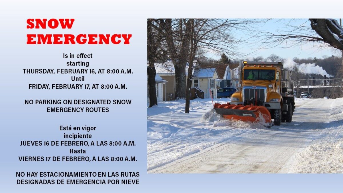
City of Muscatine declares Snow Emergency Feb. 16-17

MUSCATINE, Iowa – The City of Muscatine has declared a Snow Emergency starting at 8 a.m. Thursday (Feb. 16) through 8 a.m. Friday (Feb. 17). Muscatine is under a Winter Storm Warning and is expected to receive 4-7 inches of snow starting Wednesday night.

“Our trucks are out right now spraying areas of our streets with brine (a salt-water mixture that helps melt snow),” Brian Stineman, Public Works Director, said. “The snow plows will be out early Thursday morning and will work as long as needed to move snow off the streets.”

This is the first time that a Snow Emergency has been declared under the revised Snow Emergency Ordinance. 

Muscatine’s Snow Emergency Ordinance limits on-street parking during a declared Snow Emergency to allow plows to access and clear streets during extreme winter storms. 

According to the revised code, when weather conditions warrant the declaration of a snow emergency, motor traffic will be expedited and parking on City of Muscatine streets will be prohibited or restricted for snow plowing and other purposes.

During a declared snow emergency, no person shall park, or allow to remain parked, any vehicle on any portion of a Snow Emergency route. Here is a MAP of the Snow Emergency routes. Signage marking the designated Snow Emergency routes were installed by the City of Muscatine late last year.

Once a Snow Emergency ends there is still the possibility of parking restrictions as Department of Public Works crews push back the snow to the curb. 

The Snow Push Back policy would be implemented, if needed, once snow removal operations are complete to the appropriate levels of service on all Class I, Class II, and Class III roadways. See SNOW AND ICE CONTROL POLICY for the classifications of different roadways. 

Residents will be provided 24-hour notice prior to the implementation of the Snow Push Back policy’s odd-even parking plan. See SNOW PUSH BACK POLICY for more information on parking restrictions.

Categories
City of Muscatine Press Releases

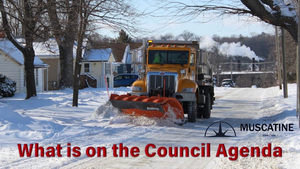
Changes to snow emergency regulations on Council agenda

MUSCATINE, Iowa – Revisions to the current City of Muscatine Snow Emergency Regulations will be the subject of a Public Hearing during Thursday’s (Aug. 18) City Council meeting. 

A virtual meeting will be held in conjunction with the in-person meeting for those who want to view the proceedings or make a comment but do not feel comfortable in attending in person. Details for joining that meeting are listed below. 

During its December 21, 2021, in-depth session the City Council agreed to move forward with updating City Code to allow for a snow emergency ordinance that would prohibit parking on posted snow routes. The potential revisions to the ordinance were presented to City Council at the July 15,2022, in-depth meeting with the Council agreeing to proceed with the revisions.

The Snow Emergency Regulations were changed in 2013 from essentially posted snow routes that would become no parking areas when a snow emergency was declared so that plows could more easily remove snow from the street. The change implemented the alternative side of the street parking policy with the thought that it would result in more vehicles being moved off the street to allow for more efficient snow removal of the streets to the curb lines.

The alternate side parking provision in the current ordinance has proven to be difficult to enforce and difficult for the public to understand and comply with. The proposed revisions to the ordinance would bring back the posted snow emergency routes where parking would be prohibited during snow removal. In addition, the revised ordinance clarifies when a snow emergency would be declared along with added sections on stalled vehicles, removal and impounding of vehicles, and citation on vehicles.

In other business Thursday, the Council is expected to:

  • Set a public hearing for September 1 on potential environmental impacts for West Hill Sanitary & Storm Sewer Separation Project Phase 6;
  • Set a public hearing for September 1 on ATV/UTV Ordinance revisions;
  • Approve the contract and bond for the 67th Avenue Sidewalk Improvements Project;
  • Approve a purchase order for a modular restroom building at Taylor Park;
  • Approve payment of economic assistance for certain small businesses in the Grandview Corridor;
  • Approve issuing purchase orders for three projects at the Weed Park Aquatic Center; and,
  • Approve a legal retention agreement for City Attorney services..

Information on the presentations and other agenda items can be found by clicking AGENDA to download a PDF version of the City Council agenda and/or attachments. 

Thursday’s City Council meeting is open to the public. Citizens who do not want to attend the in-person meeting can watch and/or participate through the GoToMeeting virtual meeting portal. Information on joining the session and how to make a comment during the meeting is listed below. The session will also be broadcast live on the City of Muscatine YouTube channel and on Muscatine Power & Water Cable Channel 2.

On-Line Participation

To view or participate virtually, click on the link below or call in to the GoToMeeting. Be sure to mute your computer, laptop, tablet or smartphone (press *6 when using phone or mute button on computer). At the appropriate time, you will be able to unmute your device to ask a question or make a comment. The public can also use the “chat” feature on GoToMeeting to pose a question to the Mayor, Council, or staff member. Those wishing to speak should use the chat box to post a message that will be seen by the mayor who will address the questions or call on the speaker in turn. Those using their phones must wait until the mayor asks for additional comments. The mayor will recognize you prior to you addressing the Council.

Muscatine City Council Meeting | Thursday, August 18, 2022 | 7:00 PM – 9:00 PM (CDT)

Join the meeting from your computer, laptop, tablet or smartphone by clicking the following link: https://www.gotomeet.me/CityofMuscatine/city-council-meeting

You can also use your phone by dialing +1 (669) 224-3412, follow the prompts, and type in Access Code 970-499-597 when prompted.

The link, phone number, and access code are the same for both meetings. You can remain logged on between meetings or exit and re-enter at the appropriate time.
 
New to GoToMeeting? Get the app now and be ready when your first meeting starts: https://global.gotomeeting.com/install/970499597

Categories
City of Muscatine Press Releases

Meteorological spring arrives, time to prepare for severe weather

MUSCATINE, Iowa – With Meteorological spring upon us, the Muscatine County Emergency Management Agency wants to remind those in the county to start preparing for severe storms. 


On average, Muscatine County residents can experience thunderstorm warnings for storms that are capable of producing damaging winds, lightning, hail, and even tornadoes.


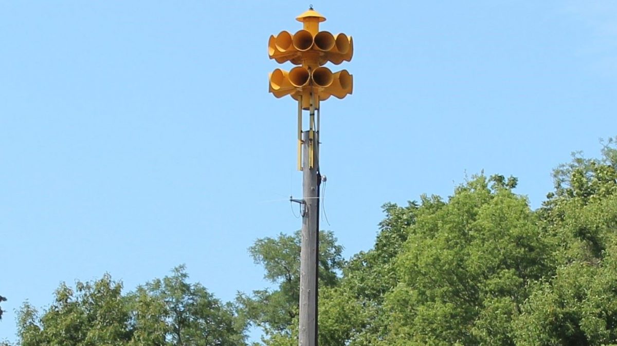
The Muscatine County Emergency Management Commission is in the process of updating the outdoor warning system sirens, many of which were the 1960’s civil defense warning devices. Each year, the Commission approves a budget to replace four (4) sirens for the fiscal year.


In cooperation with the Muscatine Area Geographic Information Consortium (MAGIC), a link has been created for Muscatine County residents to pinpoint where the outdoor warning sirens are located. Click on the following link to view the locations: OUTDOOR SIRENS


Free National Weather Service Storm Spotter Training


For those interested in becoming storm spotters, the National Weather Service will be conducting both an in-person and virtual (on-line) training. Storm spotter training will be held at 6:30 p.m., Tuesday, March 15, at Calvary Church in Muscatine. Classes cover severe weather hazards including thunderstorms and tornadoes, the general structure and movement of severe thunderstorms, identification of important storm features, and safety concerns. 


All in-person and virtual classes to be conducted by the NWS Quad Cities office, and all classes last about 2 hours. Classes are free and open to the public. Pre-registration is required for virtual classes. Classes are appropriate for all ages, but ages 10 and up will likely get the most out of the training.


Click QUAD CITIES STORM WATCHERS for more information or visit the Storm Spotter Training event notification on Facebook.


Testing and Activation of the Muscatine County-Wide Outdoor Warning System


The Muscatine County Emergency Management Agency has established a Guidance policy for Testing and Activation of the Muscatine County-Wide Outdoor Warning System. As a reminder, sirens are used to alert those who are outdoors of an imminent hazard and prompt them to go indoors and seek further information. The information will be available to the general public through the county and other municipalities’ websites.


For more information, visit the Emergency Management website, and follow them on Facebook.

Categories
City of Muscatine Press Releases

State, local health agencies moving from response to recovery

MUSCATINE, Iowa – The State Public Health Disaster Emergency Proclamation will expire at 11:59 p.m. on Tuesday, February 15, 2022. For nearly two years, the proclamation waived specific provisions in Iowa code that allowed the state to shift resources to respond to the public health emergency. As such, the state publicly reported information that was more detailed and frequent than what the agency would typically produce. This allowed the state to respond and shift resources appropriately.


The expiration of the proclamation will result in operational changes related to the state’s pandemic response. State agencies, including the Iowa Department of Public Health (IDPH), will now manage COVID-19 as part of normal daily business and reallocate resources that have been fully dedicated to the response effort to serve other important needs for Iowans. 


IDPH and your Muscatine County Public Health Department remain committed to doing the work we’ve always done around disease surveillance to protect the health of all Iowans. Moving forward the Iowa Department of Public Health will continue to provide critical data to understand COVID-19 prevalence in Iowa. The Muscatine County Public Health Department will refer our communities to IDPH for continued updates on COVID-19 beginning February 16, 2022.


Changes in Published Data:


  • Both the coronavirus.iowa.gov and vaccinateiowa.gov websites will be discontinued.
  • Weekly COVID-19 data points will be published on the IDPH website beginning February 16, 2022.
  • IDPH is no longer requiring Long Term Care facilities to notify them when they have three or more infections in residents, therefore this will no longer be reported publicly by IDPH. Instead, IDPH will use Centers for Medicare Services (CMS) data to identify and assist facilities in infection control.
  • Hospital general COVID-19 data is available through the CDC: www.cdc.gov/nchs/covid19/nhcs.htm


Moving Forward the IDPH Website, www.idph.iowa.gov, will Include:

  • Positive Cases
  • Positive tests since March of 2020 (age/sex/race)
  • Deaths since March of 2020
  • Case by county
  • Positive tests in past 7 days
  • Epi Curve since March of 2020
  • Variant breakdown by week
  • Vaccine Data
  • Total series completed
  • Booster completed
  • County map
  • Fully vaccinated (age/sex/race)


Public Health Work Continues

  • First COVID-19 data upload to IDPH website will be February 16, 2022
  • Access to COVID-19 testing and vaccine remain unchanged.
  • At this time, Test Iowa at Home will continue unchanged. www.testiowa.com
  • COVID-19 vaccines and therapeutic allocations continue.


For information related to COVID-19, visit www.idph.iowa.gov/ or Coronavirus Disease 2019 (COVID-19) | CDC.